
Pole Locations and Surveyed Trees
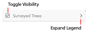
Users may use the “plus” (+) button on the map to zoom in and the "minus" (-) button to zoom out. Use the check boxes in the legend to toggle layer visibility on and off, and the expand arrows (>) to expand that layer's legend. BY clicking any tree on the map, you can see view the data associated with it.
Trees are shown as “impacted” if they are close enough to the proposed lines to potentially need to be removed. Most large trees with a certain trunk diameter are considered “significant” by various city Codes. See the Final EIS for additional information on impacts and City regulations regarding trees. The locations of existing poles were surveyed by PSE. Locations shown for existing poles indicate the center point of the existing H-frame structures. Proposed poles are approximate locations. See the Final EIS for descriptions of pole types for each segment and option. Accuracy and completeness of the information on this map is not guaranteed.
Sources:
PSE (Puget Sound Energy). 2017. GIS, CAD, and static map data provided to Environmental Science Associates (ESA), Seattle, WA, by PSE, Bellevue, WA. Included files titled North_8-3-17.dxf and South_8-3-17.dxf (sent on August 3, 2017), and file titled energize eastside non-variance (4-1 to RIC)_plan strs only_rev p (sent on December 27, 2017).
The Watershed Company. 2016. GIS Dataset labeled as twc_ee_veg_impact_results_20160914. September 14, 2016
The Watershed Company. 2017. GIS Dataset Labeled as 2017-12-15 Data for EIS Consultant. December 15, 2017.